
The Right Service for Your Land. Nothing More. Nothing Less.
AeroTerraX offers a structured service pathway — from foundational soil testing to comprehensive land intelligence and regenerative planning. Every tier is designed to deliver exactly what your property needs at the scale your operation demands.
AeroTerraX is currently in system validation and is not accepting new clients at this time. Services are provided here for informational purposes. Use the contact page to be notified when we open for client engagements.
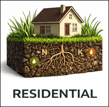


Residential Lawn & Garden — Single Sample One soil sample. One clear answer. Covers a single lawn area or garden bed with a full 15-parameter nutrient analysis and same-day results. The starting point for any homeowner who wants to stop guessing and start managing.
Residential Lawn & Garden — Standard Package Two samples, two zones. Covers front and back lawn or a lawn and garden combination. Zone-specific recommendations so you are not applying the same fix to ground that has different needs.
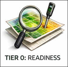
Tier 0 — Readiness Screening Not sure where to start? This is where. A structured property consultation using aerial imagery, soil surveys, and public data to assess your land's condition and identify the right service level before you commit to a larger investment. Designed to front-load clarity and ensure your investment targets the right priorities from the beginning.
Tier 2 — Advanced Soil Testing Double the sampling density of Tier 1, compaction testing included, and full GIS file outputs. Identifies smaller-scale variability patterns that two-acre grids miss, enabling more precise input targeting and zone-specific management. Designed for producers who want to stop applying inputs uniformly across ground that is anything but uniform.
Tier 4 — Comprehensive Stewardship Planning Built on top of Tier 3 data, this tier produces a decision-grade management plan — what to do, where and when. Multi-year implementation roadmap, habitat and wildlife assessment, hydrology and erosion management, and contractor guidance. For private-pay clients who want professional planning without the constraints of government cost-share programs.
Habitat & Food Plot — Single Plot Consultation Professional planning for a single food plot location. Covers site evaluation for soil suitability, sun exposure, access, and drainage — combined with species and seed mix recommendations, seeding rates, and fertility and lime guidance. The right starting point for a small property, a first-time food plotter, or anyone testing a new location before committing to a larger habitat strategy.
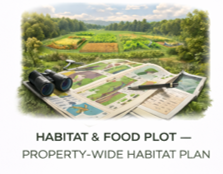
Habitat & Food Plot — Property-Wide Habitat Plan A fully integrated food plot and habitat system for properties with five or more plot locations. Site selection is driven by aerial mapping and soil data. Includes a comprehensive habitat assessment covering food, cover, water, and connectivity — along with a multi-year implementation roadmap, budget allocation guidance across plots and years, and a monitoring framework to track success. Designed for serious wildlife managers and conservation-focused landowners committed to a long-term habitat strategy.


Small Farm Soil Assessment — Base Foundational soil intelligence for properties up to five acres. Three to five GPS-tagged composite samples with nutrient analysis, a basic site map, and fertilizer and lime recommendations by zone. Same-day field results.
Small Farm Soil Assessment — Premium A deeper look at complex small properties or intensive operations. Five to eight samples, full nutrient analysis, and GIS outputs compatible with Google Earth and mapping platforms. Designed for properties where variability matters.
Tier 1 — Basic Soil Testing Professional fertility mapping for informed fertilizer and lime decisions. Two-acre grid sampling with GPS-tagged locations, full nutrient analysis across 15+ parameters, and spatial variability maps showing where your land needs attention and where it does not. The right starting point for budget-conscious producers establishing a baseline.
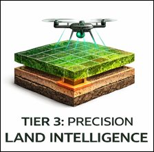
Tier 3 — Precision Land Intelligence This is where soil data, vegetation health, and terrain analysis come together into a single integrated picture. Drone-derived NDVI, NDRE, and RGB imagery correlated with one-acre grid soil sampling and compaction testing. Tier 3 does not just show what is happening on your land — it shows why, and what to address first.
Tier 5 — Regenerative Land Conversion The most comprehensive service AeroTerraX offers. Everything in Tier 4 plus enhanced soil carbon baseline, carbon market readiness evaluation, regenerative system design with species specifications, and a long-term monitoring framework. Designed for landowners committed to transformational change — not piecemeal improvements, but a complete regenerative vision built on verified data and a multi-year roadmap.
Habitat & Food Plot — Multiple Plot Planning A comprehensive multi-plot strategy for properties with two to four food plot locations. Includes species rotation planning, seasonal diversity across plots, a staggered planting schedule for extended food availability, and a spatial distribution strategy designed to minimize hunting pressure while maximizing wildlife coverage. Designed for hunting property managers and landowners pursuing a multi-season nutrition and habitat approach.
Habitat & Food Plot — Implementation Support Coordination support for the on-the-ground execution of your food plot plan. Covers equipment and labor coordination for plot preparation, seeding, and maintenance — either working with your preferred contractor or providing referrals. Quoted individually based on plot size, equipment requirements, timing, and location. Contact us to discuss your specific situation.
Services
Filters
No results found
No results match your search. Try removing a few filters.